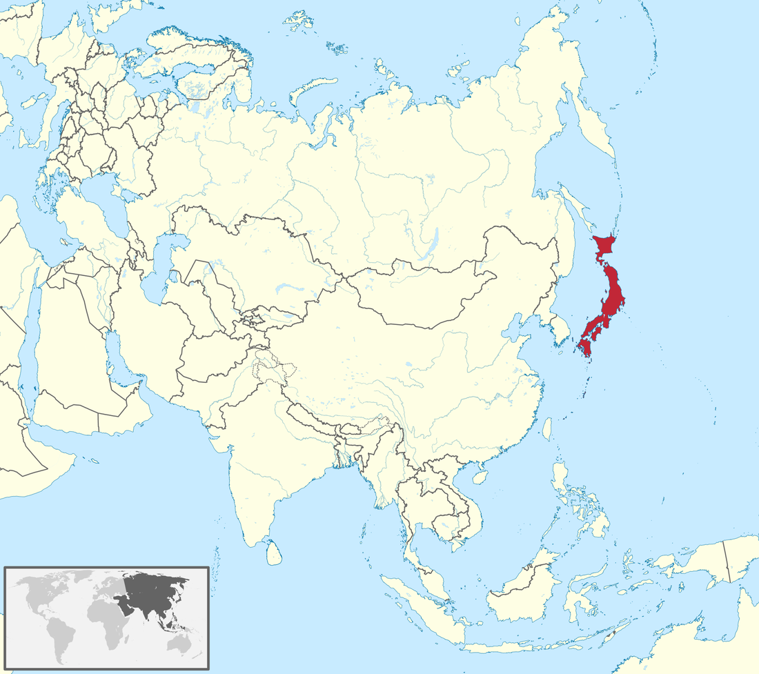
Regional Map
Google Maps of Tokyo
Total Area: 377,915 square kilometers
Land Area: 364,485 square kilometers Water Area: 13,430 square kilometers Size Comparative to US: The US has a total area of 9.834 million square kilometers so it is about 26 times larger in total area than Japan which makes it extremely small compared to the US Bordering Countries: Japan is an island nation, but the closest nations nearby Japan are Russia, North Korea, South Korea, South Korea, China, and Taiwan Total Distance of Land Boundaries: None ( It's an island nation as stated previously) Total Distance of Coastline: 29,751 kilometers Climate Description: Tropical in the south and has a cool temperate climate in the north Terrain Description: It is very mountainous and rugged; about 70% of the total land is mountains Point of Lowest Elevation: Hachirogata Lake which lies 4 meters below sea level Point of Highest Elevation: Mount Fuji with its peak Fujiyama which sits 3,776.24 meters above sea level |

Specific Country Map

|
